
- cross-posted to:
- [email protected]
- cross-posted to:
- [email protected]
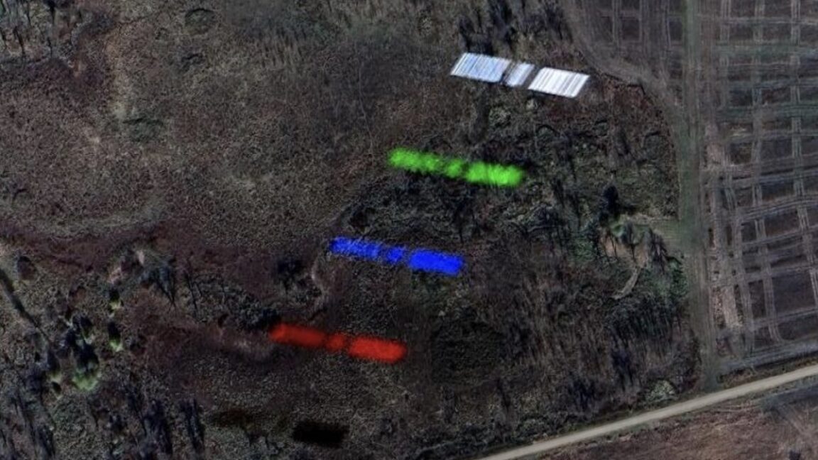
While the B-2’s motion caused it to appear a little smeared in the Google Earth image a few years ago, the satellite’s velocity created a different artifact. The satellite appears five times in different colors, which tells us something about how the image was made. Airbus’ Pleiades satellites take pictures in multiple spectral bands: blue, green, red, panchromatic, and near-infrared.
At lower left, the black outline of the satellite is the near-infrared capture. Moving up, you can see the satellite in red, blue, and green, followed by the panchromatic, or black-and-white, snapshot with the sharpest resolution. Typically, the Pleiades satellites record these images a split-second apart and combine the colors to generate an accurate representation of what the human eye might see. But this doesn’t work so well for a target moving at nearly 5 miles per second.
You must log in or register to comment.